
La Paz es una ciudad hermosa, muy colonial, con muchas calles de piedra y mucha vida. En vez de negocios hay puestos de lo que se imaginen: inodoros, elementos de ferreteria, artesanias, comida, etc etc. parece que sale caro el alquiler de locales..
Y de nuevo, mas agencias de turismo y negocios de artesanias que gente.
Una vez en La Paz nos tomamos un día de descanso para prepararnos para el Choro. El 2de octubre a la nche fuimos a cenar la La Comedie, uno de nuestros lugares favortios de La Paz. No les dije a los chicos que era mi cumple, per se enteraron igual por facebook. Asi que me sorprendieron con una velita en el postre y un equeco de alpaca (creo) y me invitaron la cena. Unos amores.
El Choro trek es bastante conocido en Bolivia, ya que es un camino precolombino recorrido por los incas para intercambiar productos entre el Altiplano y los valles. Hasta el dia de hoy se sigue haciendo, la gente usa llamas para transportar vegetales desde pequeños poblados hasta la Cumbre, desde donde los camiones parten para La Paz.
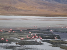
Salimos a la mañana temprano en camioneta y despues de 1 hora y media (en realidad bastante mas despues de las vueltas de nuestro guia..) de viaje llegamos a La Cumbre (4700 m.s.n.m). Ahi comienza la caminata hacia el este, internandonos en el Parque Nacional de Cotapata. 2 guias nos acompañaron, cargando la comida y las carpas. En total son unos 60km aproximadamente, y se llega hasta la zona de Yungas, que es el area subtropical. Es realmente impresionante ver como cambia el paisaje y sobre todo el clima.
El primer dia descendimos por el camino del inca en el valle de Chucura. Llegamos hasta Semana Pampa, donde paramos a comer, despues de un par de horas de caminata entre las nubes literalmente. Me encanto ver a lo largo de todas los poblados que pasamos que la gente habla aymara, idioma de un grupo indigena que se asento aproximadamente en 1200 DC en la meseta del Lago Titicaca despues de la caida de la cultura del Tiwanacu, y que no pudieron ser dominados por los Incas.  Despues seguimos camino, toda bajada (los pies me quedaron a la miseria, y no te digo las rodillitas!), hasta llegar a Challapampa (2,800 mts) en donde los guias armaron las carpas y prepararon de comer. Ya se podia sentir algo del calorcito subtropical, que desapareceria por completo con la caida de la noche.
El segundo dia partimos despues del desayuno. Despues de 4 hs de caminata llegamos a un puente colgante que atraviesa el río Chucura, pura vegetación subtropical a esta altura y seguimos la caminata por la ladera hacia el río Jucumarini, con unas cascaditas, hermosas, bastante calor y varios tipos de insectos acechando. 
Supuestamente ese dia ibamos a acampar en San Francisco. Pero el guía nos decia que la caminata al tercer dia iba a ser muy dura desde San Francisco hasta el Chairo, punto de llegada, ya que el lugar es rocoso y las piedras emanan mucho calor. Pero si decidiamos seguir hasta Bella Vista, el proximo camping, habia que subir por la llamada Cuesta del Diablo, nombre nunca mas apropiado para una cuesta.
Llegamos a Bella Vista, sin aliento, tipo 5 de la tarde, para ver que el lugar estaba desierto, ni siquiera el cuidador o dueño estaban, y sin agua. No nos hizo mucha gracia, ya que habiamos pasado 10hs practicamente caminando. El guia propuso entonces ir hasta el albergue Urpuma, ubicado en Sandillani, en el corazón del Parque Nacional y Área Natural de Manejo Integrado Cotapata. Este lugar lo maneja un japones. Y teniamos la opcion de alojarnos ahi o hacer carpa. jaja! a esta altura el espiritu aventurero ya estaba bastante bajo.. asi que de una que preferiamos una buena cama con sabanas "limpias". Digo "limpias" porque en realidad estaban llenas de bichitos que se hicieron la fiesta con mis pies y tobillos.
Llegamos al ecolodge alrededor de las 7, ya de noche, hechos pelotas, despues de 12 hs y 28km de caminata.. no habia luz, pero nos bañamos igual con agua fría. Y esa noche Pete se enfermo, creemos que con la comida de esa cena ya que los guias no tenian luz (mi teoria). Y curiosamente los dos que comimos el menu vegetariano no pudimos probar bocado al dia siguiente. 
El tercer dia pasamos por unas ruinas preincaicas (de la cultura aymara), mas paisaijes subtropicales, estabamos bastante cansados pero contentos porque solo teniamos 3 hs de caminata para llegar al Chairo (1,200 msnm) en donde una mini van nos llevaria hasta Coroico, y desde ahi nos tomariamos un bus a La Paz. En el trayecto Coroico La Paz pudimos ver el famoso camino de la muerte, realmente impresionante, el cual Bass y Keith hicieron en bici al dia siguiente.
La Paz is a great city, very colonial, with loads of stone streets. And again, more tour agencies and street stands than people.
Once we got there we had a day to relax to get back on the road the next day to do El Choro trek. That 2nd of October (mi birthday) we went to a French restaurant one of our favourite restaurants in La Paz. I didn´t tell the guys it was my birthday, but thy found out anyway thru facebook. So they surprised me with a biirthday candle on my dessert, an "equeco" made in alpaca (i guess) and the invited me for dinner. Very cute!
El Choro trek is well known in Bolivia, a pre-columbian road used by the Incas for produce exchange between the andean highlands and the valley. And still today people use llamas to transport goodies (like potatoes) from the small villages to La Cumbre where trucks take the stuff to La Paz.
On the first day of the trek ee headed off early in the morning and after one and a half hs (I think it was more than that as the guide took his time to finish the shopping) we got to La Cumbre 4,700 mts asl.  The trek started there and basically we walked to the East into Cotapata National Park, 60 km approx. 2 guides went with us carrying food and tents. The trek ends in the Yungas, subtropical area, where the conditions are ideal to grow coca. We were impressed by the change in the landscape and weather.
First day we descended thru the Inca road in the Chucura Valley. First stop was in Semana Pampa where we had lunch after a 2 hs (or so) walk in the clouds literally so to speak. What really impressed me was the fact that people from the villages along the way still speak the original indigenous language, aymara. This etnic group occupied the Titicaca area from 1200 AD after the extintion of the Tiwanacu culture, and they couldn´t be dominated by the Incas.
The rest of the road was downhill, my feet couln´t hurt so much and not to mention my knees! We got to Challapampa camping site, 2800 mts asl, where the guides put up the tents and cooked dinner, which took more than an hour for just noodles with sauce... At this point we started feeling the subtropical weather which would disapear right after the sunset.
On the second day we begun our journey as soon as we had breakfast. After 4 hs walk we got to a hanging bridge on the Chucura river, full on with the subtropical landscape and gorgeus cascades and of course loads of insects atacking any unattended body spot.
We were supposed to camp at San Francisco on that day. But the guide mentioned it was going to be really tough to do the walk the next morning to the last stop of the trek, as the road is very rocky and the heat over the stones rises dramatically the temperature of the area. But Bella Vista, the next camping site available in the area could be reached after doing the Cuesta del Diablo, an uphill road, for one and a half hs. So, to make our lives easier we decided to keep on walking to Bella Vista (n the photo below), really keen to have a good break after 10 hs walk. 
We got there to find out there wasn´t a soul there and there was no water or place where to camp. We weren´t very happy with the guide who quickly said there was another place, called Urpuma ecoldge (in the photo bleow), located in Sandilani in the heart of the Cotapata National Park where we could take a shower and sleep in a comfy bed, just one hour way, no uphill. We didn´t have much choice, we kept on walking.
We got to this ecolodge, run by a Japanese guy, at 7 pm, totally wrecked after 12 hs and 28 kms walk. The owner had a problem with the electricity supplier, so there wasn´t any. We took a cold shower anyway. We had the option of camping or getting a bed, the adventure spirit was quite low at this point, everybody opted for a bed with ´clean´sheets. I say ´clean´because mine was full of bed bugs who had a feast with my feet and ankles.
The guide took his time (aaaaages!) to cook dinner that night. Pete got sick, I rekon it was because there was no light (my theory). And curiously the ones that eat vegetarian (Pete and I) couldn´t eat anything at all the next day.
On the third day we went past pre-Inca ruins, from Aymaran culture, more subtropical landscapes. We were pretty tired but really happy to have the mission almost accomplished, only 3 hs walk left to get to El Chairo (1200 mts asl). From there we would go to Coroico in a minivan and we would take a bus or something back to La Paz. On our way to La Paz we could appreciate the famous Dead Road, absolutely impressive, where Bass and Keith would descend on a push bike the next day.


New year, new me
7 years ago
2 comments:
Que espiritu aventurero Dani! Te vas preparando para Macchu Picchu.
Si, estoy muy entusiasmada con Machu Picchu, no veo las horas!!
Post a Comment